THE HOCKANUM RIVER FLOWS IN A VERY WINDING COURSE FOR 25 MILES FROM THE SHENIPSIT RESERVOIR THROUGH THE FOUR
TOWNS OF ELLINGTON, VERNON, MANCHESTER AND EAST HARTFORD, TO EMPTY INTO THE CT RIVER JUST NORTH OF THE CHARTER
OAK BRIDGE. THE RIVER COURSES FOR SEVEN MILES THROUGH MANCHESTER, FROM THE VERNON-MANCHESTER TOWN LINE, NEAR THE
MOTEL 6 ON ROUTE 83, AND LEAVES MANCHESTER BEHIND THE McDONALDS RESTAURANT ON BURNSIDE AVE. EAST HARTFORD.
(ed. notes below added Aug 21, 2017 by T. Mitchell of Rivers Alliance CT and J Hall of HRWA).
#1 Access out & in River. NOT FOR NOVICES.
Turn off Route 83, Vernon, into entrance road to Motel 6, (ed. note: try gps 51 Hartford Turnpike, Vernon,
41.81878, -72.5043) park in first lot on right. 100 ft. upstream, put boat in at grass ramp opening to river
(ed. note: this is just below the confluence of the
Tankerhoosen River, just upstream from the the
Oakland hiking trail. River elevation here 172 feet above sea level. Flat easy entry here. Class one rapids,
one foot high steel dam 200 feet downstream, mild swift water, close to I-84 and businesses, one mile downstream
quickly becomes more rocky with one foot ledge diagonally across river, class two to three rapids after passing
under three street bridges, may carry around rapids on left for 500 feet. Best to view this section of rapids
behind Beacon Light, Oakland Street before entering these rapids, NOT FOR NOVICES. River then becomes flat and
enters Union Pond, about one mile across length of pond, sometimes headwind, take out & portage to left of dam,
at southwest corner of pond for further trip downstream. Distance from access #1 to dam & access #2 is 9700 feet
or 1.84 miles. Elevation next to dam 142 feet. Segment drop 30 feet.
#2A Access in & out Union Pond only.
Park & boat ramp close off North School Street at junction of Lydall Brook and southeast corner of Union Pond to
tour pond, elevation 142 feet, perimeter around pond - 9500 feet. Segment drop 0 feet. (ed. note: Reference map of
#2 Access in River.
Park next to dam off Union Street, then carry down concrete steps & rocky slope down to
river, elevation here 120 feet. Class one to two rapids, occasional boulder, nice forest valley, sharp turn to
left, go under North Main Street bridge, take right channel under bridge, then quick left around gravel bank,
more valley forest, easy pools and rapids, low branches, high railroad trestle overhead, easy take out on grassy
slope on left 50 feet downstream from trestle. This is access point #3. Distance from #2 to #3 is 4400 feet or
.83 miles. Elevation here 97 feet. Segment drop 23 feet. Segment drop 0 feet. (ed. note: Reference map of
#3 Access out & in River.
North on Fleming Road off Hilliard Street, park at end of down hill road, carry 80 feet down grass slope to flat
river bank (ed. note: near north end of
#4 Access out & in River.
Park in lot at northeast corner of Hilliard Street and New State Road (Hilliard
hiking trail), carry 40 feet on wooded path to slope to river. New State Road bridge close by, curves, tree
obstacles, brief class two rapids, rocks, best flow on right, low trees overhead, many turns, flatter water,
curves, big low tree, high tension towers, flat take out on north side of Middle Turnpike West (Routes 6 & 44).
Distance from #4 to #5 is 6400 feet or 1.21 miles. Elevation here 70 feet. Segment drop 8 feet.
#5 Access out & in River.
Park on north side just off Middle Turnpike West
TOTAL RIVER DISTANCE FROM QUALITY INN, VERNON TO McDONALD'S, BURNSIDE AVENUE, EAST HARTFORD IS 7.0 MILES.
LOW WATER NOTES: Access points # 1, 2 & 3 are only good when water levels are moderate to high. River
passage during low water seasons is difficult due to many shallow spots. Access points # 4 & 5 have somewhat
better water depths for dry seasons. Union Pond good at all seasons.
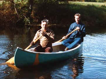
SAFETY NOTES: Never canoe or kayak alone! Head gear is recommended. Extra paddle is a good idea. Personal
flotation device essential. Wet suit in cold weather is good. Bow or stern line important. Water bottle is good.
Bring waterproof camera. Happy boating.
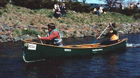
Information on registration for the Annual Hockanum River Canoe/Kayak Race held each (early) April is
available at the Manchester Town Hall: 860-647-5235.
The Hockanum River Linear Committee is a subcommittee of the Town of Manchester Conservation Commission.
This subcommittee (HRLPC) has been in existence since 1970 and has been working to clear obstacles in the river
for boating and to maintain trails for hikers along the river in Manchester since that early date. The group is
made up of volunteers dedicated to the scenic beauty, environmental clean-up efforts, and general preservation
of the natural open space green belt along the river. Any interested members of the community are urged to join
and help at any convenient times with our ongoing dedication to the Hockanum.
For more information about hikes or participation in our committee, please call 647-5235 at the Town Hall
during the day, and 649-5678 evenings and weekends. Thanks for your interest.